


Google Maps improves the definition of their maps with a satellite 700 billion pixels


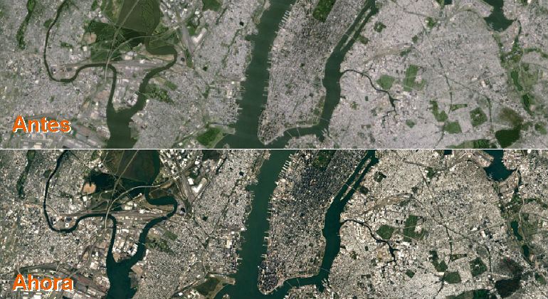
Since yesterday, more than 1,000 million people using Google Maps every day have been able to appreciate how the quality of cartographic shots have improved compared to how they looked a few days ago. The reason? Alphabet (parent company) has added to its mapping service and the Earth Landsat 8 satellite, which lets you take clearer images with a resolution of 700 pixels billion.
The Landsat 8, which was launched into orbit in 2013, has the most advanced sensor USGS / NASA program being able to capture “much more detailed than its predecessors to reflect more real than their predecessors color” images, Google says.
In addition to its sensor, the company explains that Landsat 8 incorporates new image processing techniques never seen before satellites that allow shots to be much sharper. And, we must bear in mind that the images taken by satellites are not always taken from the same place and have climatic variations that prevent a clear picture, something that solves a large extent this processing, leveraging the lightest pixels to join them with others without problems.
Source: http://www.eleconomista.es/
